In our continuing efforts to calm traffic along the gravel section of Crawford, we’ve included a helpful reminder to manage expectations of people that might be using our road as a shortcut…

In our continuing efforts to calm traffic along the gravel section of Crawford, we’ve included a helpful reminder to manage expectations of people that might be using our road as a shortcut…
Thank you all for attending the annual meeting. We got a lot done, and your input is immensely valuable. We appreciate it!
As requested, we’ve added a contact form to the website. If you have questions, feedback, or just want to reach out and talk, go ahead click on the “Contact Us” to the right.
The form will send us an email, and we’ll get right back to you!
Thanks again!

Our neighbor, John DeWit, is having an exhibition at the Foster White Gallery in Seattle. He’s showcasing a completely reimagined environment for his work!
Just a quick reminder that our annual meeting is coming up Wednesday. We’d love to see you there!

The preliminary engineering work is being completed on the new road for the Airpark Access Project, and they’ve given us a copy of the most recent iteration of their design.
Preliminary Design – Across from Craw – Full PDF

It’s important to understand that this design is preliminary and conceptual: there will be revisions and changes as the process moves forward. However, now would also be a great time to comment and get your opinion heard!
We’ll be talking more about the WAAP and this design at our upcoming annual meeting on Feb 27th.
Stay tuned!

Whidbey Airpark and Whidbey Telecom are partnering to put another weather station up on the tall Whidbey Telecom cell phone tower, just off Crawford!
Soon, we’ll have detailed weather information both above, and below the treeline…
Watch this space for updates!
Our condolences go out to the family and friends of Marc Drake at this time, and we hope for a speedy recovery for the woman involved.
The South Whidbey Record has more information.
Thanks to Phil, Tara, and Sky for clearing those trees across Crawford almost as quickly as they fell!

I’ve been fiddling around with data science recently, and I thought that I would share with you a quick visualization that I’ve been working on.
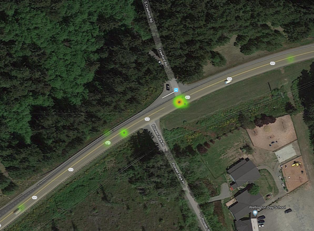
One of the things the Whidbey Airpark Access Project is working to resolve are the safety concerns around the Crawford Rd and SR 525 intersection.
Although I provided all the data in my post on the bulletin boards, the following is a nice, at-a glance, visualization of all the accidents since 2005 that occurred within 500 feet of the intersection.
(EDIT – Updated DEC 30 2018 with new image.)